


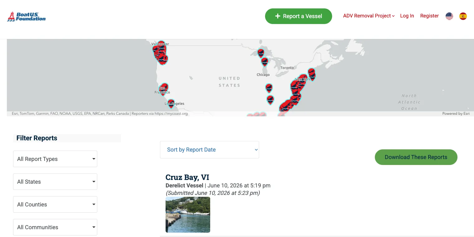
The BoatUS Abandoned Boat Database is exposing a crisis most Americans never see. Thousands of boats are rotting in American waterways right now. Half-sunken sailboats wedge against mangroves. Rusted steel hulls leach fuel into estuaries. Fiberglass wrecks clog the navigation channels that commercial fishing boats depend on every day.
For decades, nobody could fully quantify this problem. Local agencies tracked the boats in their jurisdiction. Marinas knew which slips had gone dark for years. But no national picture existed — no unified record, no searchable map that showed the true scope of what the boating community calls the abandoned and derelict vessel (ADV) problem.
That changed when the BoatUS Foundation Abandoned Boat Database went live. It’s a publicly accessible, crowdsourced, and institutionally supported system. For the first time, anyone can search, report, and track abandoned vessels across the entire country.
This is a quiet but genuinely significant development in how the U.S. manages marine debris. If you spend time on the water, or live near a coastline, it’s worth understanding what it actually does — and where it still falls short.
What Is the BoatUS Abandoned Boat Database, and How Did It Come to Exist?
NOAA’s Marine Debris Program awarded a $10 million grant to the BoatUS Foundation for Boating Safety and Clean Water in 2023. The grant funded several components: physical vessel removal in coastal communities, a national conference on sustainable vessel disposal, and the creation of a centralized database to track ADVs nationwide.
Working in partnership with NOAA, the BoatUS Foundation built the database as the first coordinated, nationwide attempt to quantify and combat the derelict boat problem. The platform runs on MyCoast, a community reporting infrastructure with a proven track record in coastal hazard documentation. That gave the project a solid technical foundation from day one.
The Foundation designed the database to give organizations and the public a place to report ADVs. Reports help identify problem areas, quantify the scope, and track prevention and removal efforts. That dual purpose — public input combined with institutional tracking — makes this more than a simple complaint form. It functions as a living record of a national problem.
Why This Problem Is Bigger Than Most People Realize
Before digging into the database itself, it helps to understand why anyone built it. Abandoned boats aren’t a niche issue.
Derelict vessels crush and smother sensitive seagrass and coral habitats. They leak fuel and other pollutants into the water column. They block navigation channels and drive up removal costs for coastal communities. The BoatUS Foundation puts the average removal cost for a single derelict boat at $24,000.
That number alone reframes the problem. A fiberglass sloop sitting abandoned in a Florida estuary isn’t just an eyesore. It’s a potential $24,000 liability for whichever government agency eventually has to deal with it. Multiply that across thousands of vessels and you quickly understand why state and local agencies have been overwhelmed for years.
The problem also spreads across jurisdictions in ways that make centralized action difficult. One derelict shrimp boat might sit in a Louisiana bayou under federal jurisdiction. Another might occupy state-managed tidelands in Oregon. A third might block a tribal harbor in Washington State.
Without a shared database, each one gets handled in isolation — or ignored entirely. Identifying and tracking ADVs lets authorities take proactive steps to prevent new ones from entering waterways. It also builds collaboration across agencies and stakeholders who would otherwise never coordinate.
Inside the BoatUS Abandoned Boat Database: Interface and Features
Open the ADV reporting platform and the first thing you see is a map, not a table. An interactive U.S. map fills the screen. Red vessel markers dot coastal regions and inland waterways. You can zoom in and out freely, pan to any state or county, and immediately grasp where reports concentrate.
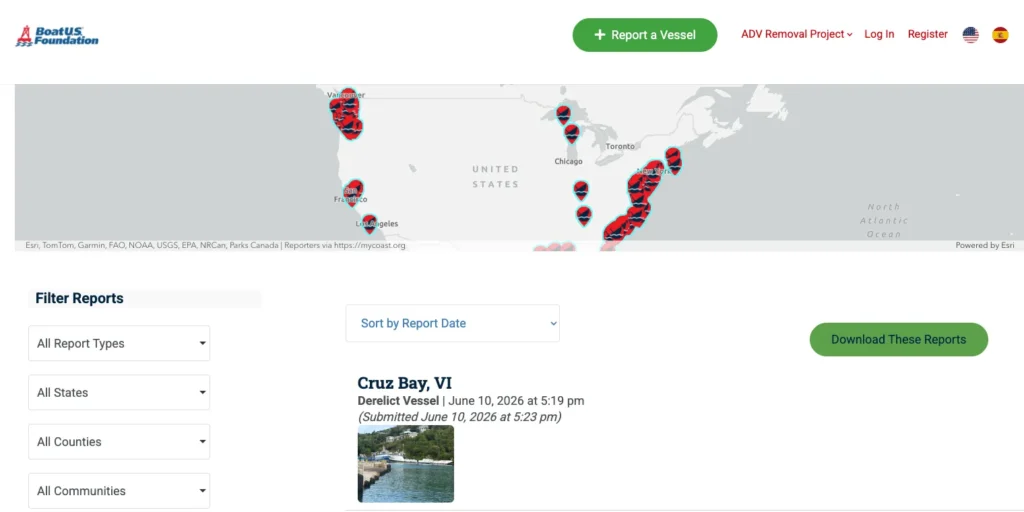
Click any red marker and a data card pops up: a photograph of the vessel (when available), its reported location, and a link to the full report. Leading with a visual is a smart design choice. This is a spatial problem — “where are the abandoned boats?” — and a map answers that question faster than any list could.
Scroll below the map and the individual records appear, along with a robust set of filters. You can narrow results by:
- Report type — initial sightings, follow-up observations, or removal confirmations
- State, county, community, neighborhood, and locality — granular enough to search within a specific marina district
- Start and end date — useful for spotting vessels that generate repeat reports over time
- Sort order — by report date or submission date
Each full report packs in a substantial amount of data. Beyond the photograph and geographic pin, you’ll find the vessel’s name, type, hull type, size, hull color, make and model, registration number, registration expiration, and hull ID number.
A tidal overview and weather overview section capture the conditions at the time of the sighting. Additional fields cover accessibility (can someone reach the vessel by boat, by shore, or not at all?), who submitted the report, and any extra observations the reporter wanted to add.
A well-completed report gives a removal contractor or state agency nearly everything they need to begin assessing a vessel for extraction. The database is genuinely functional — not just symbolic.
Who Is Actually Using This, and for What Purpose?
The database serves multiple overlapping audiences. That’s visible in how the data fields are structured.
Coastal residents and recreational boaters do most of the reporting. Spot something abandoned in your local harbor and the platform gives you a fast, structured way to document it with a photo, location pin, and vessel description. That’s far more accessible than calling a Coast Guard hotline and hoping someone follows up.
State and local marine agencies are probably the most important institutional users. A report with hull ID and registration number lets agencies cross-reference state DMV or vessel registration databases. That can lead to owner identification and, eventually, liability enforcement.
States with strong ADV laws — like Washington and California — can act on this data quickly. States with weaker statutory frameworks are less able to move fast, but the data still builds the case for reform.
Removal contractors and environmental consultants use the database to find vessels in their operating regions, prioritize projects, and build grant applications. Because the BoatUS Foundation also distributes removal grants through this program, the database creates a pipeline from problem identification to funded remediation.
Journalists, researchers, and policy advocates can draw on the aggregated data to push for increased ADV funding or legislative action at the state level. A searchable public record of where the problem is worst is a powerful advocacy tool.
Tracking ADVs builds public awareness. It encourages responsible boating practices and helps prevent new cases from developing.
It’s worth knowing what this database is not. It doesn’t handle registration lookups. It isn’t a Coast Guard incident database. It’s a crowdsourced environmental and safety reporting system — and that makes it one of a kind. For broader environmental accountability, tools like ESG databases track corporate sustainability and environmental compliance in a similar spirit of public transparency.
How It Compares to Other Marine Databases
Several other public and institutional databases cover related ground. None of them do what this one does.
The NOAA Marine Debris Program tracks marine debris broadly. It doesn’t offer a vessel-specific, searchable, public-facing database with individual vessel records. Coast Guard incident reports exist, but you need a FOIA request to get them, and they aren’t built for public search.
State vessel registration databases exist in most states but vary wildly in what they publish and in what format. The BoatUS database combines crowdsourced reporting, standardized vessel-level data fields, geographic visualization, and integration with a removal grant program.
The MyCoast platform also brings an established track record in coastal observation data management. That gives the project credibility that a purpose-built government IT system might have struggled to build on a similar timeline.
The distinctions matter. Registration databases answer “who owns this boat.” Incident databases answer “what happened to this boat.” The ADV database answers “where is an abandoned boat right now” — a question the others don’t even try to address.
This kind of environmental transparency has parallels in the corporate world too, where ESG databases hold companies accountable for their environmental footprint.
The Grant Program Behind the Database
The database doesn’t exist in isolation. It’s part of a larger removal initiative funded by the same NOAA grant. The Foundation has already awarded grants for ADV removal projects in Alaska, Guam, Louisiana, Maine, North Carolina, Oregon, the U.S. Virgin Islands, and Washington.
Projects range from removing seven vessels in the remote City and Borough of Yakutat, Alaska, to an ambitious effort by the Terrebonne Parish Consolidated Government in Louisiana targeting more than 150 ADVs in the Barataria-Terrebonne National Estuary.
The scale is significant. Terrebonne Parish alone — 150 vessels — represents roughly $3.6 million in removal costs at the $24,000 average. These are major projects happening in some of the most ecologically sensitive waterways in the country.
Individual grant awards range from $50,000 to $1,000,000 per project. The program prioritizes projects that benefit tribal or underserved communities, marine habitats, and local economies. Data from the public database feeds into future funding rounds, creating a feedback loop between public observation and institutional response.
BoatUS Abandoned Boat Database: Limitations and Data Gaps
Any honest assessment of this resource has to acknowledge what it can’t do.
Reporter accuracy drives data quality. The platform has no way to verify whether a submitted vessel description is accurate, whether the photograph is current, or whether the GPS coordinates are precise. A well-meaning neighbor who can’t tell a wooden ketch from a fiberglass sloop will still submit a report — and whatever vessel type they guess enters the database as fact.
Agencies can follow up and correct records, but this is an inherent weakness of any crowdsourced system.
Geographic coverage is uneven. States with active boating communities generate far more reports than states with lower recreational boating participation or limited coastal access. The database probably underrepresents ADV problems in less-trafficked inland waterways. It likely over-represents problems in high-visibility coastal areas. The map may look more complete than it actually is.
Resolution status isn’t tracked in real time. The database captures initial reports well. Whether a given vessel was actually removed doesn’t always appear in the record promptly. A report from two years ago may describe a vessel that no longer exists, has deteriorated further, or has drifted to a new location. A clear “resolved/unresolved” status field would close this gap significantly.
Ownership and legal information stay limited. Reports include registration numbers, but the database doesn’t cross-reference state vessel registration systems. A registration number in a report doesn’t automatically reveal who owns the vessel or what legal authority exists to remove it. That requires follow-up with state agencies — a step that demands resources not every community can spare.
Transparency comes with privacy trade-offs. The database is publicly accessible. When someone can infer vessel owner information from a registration number, that information is effectively public. This aligns with how vessel registration works in most states, but it’s worth noting for anyone thinking carefully about what transparency means in practice.
The Bigger Picture: Accountability, Transparency, and What Comes Next
This database represents something beyond its immediate utility. It signals a shift toward public accountability in marine environmental management.
For a long time, the abandoned boat problem scattered across dozens of state agencies. Each managed its own records, in its own format, with its own funding constraints. The national scope stayed essentially invisible.
A searchable, nationally aggregated, publicly accessible database doesn’t fix that overnight. But it changes the conversation. When anyone can pull up a map and see eighteen reported derelict vessels in a particular estuary, that information becomes actionable.
Journalists can report on it. Advocates can cite it in legislative hearings. Community members can use it when pushing local officials to act.
“When we finally understand the scope of the problem, communities all over the country will be better able to remove abandoned and derelict vessels on their local coastlines. With the information the database provides, they will be able to know exactly where they need to dedicate resources.” — Alanna Keating, Director of Outreach, BoatUS Foundation
That’s a pragmatic framing of what a database like this actually accomplishes. It doesn’t pull a single boat out of the water. It doesn’t rewrite state law. What it does is make the invisible visible — and in environmental policy, that’s usually the necessary first step.
The BoatUS Abandoned Boat Database isn’t perfect. But it’s operational, publicly accessible, and already shaping real removal decisions. In the world of environmental data infrastructure, that counts as a meaningful achievement.
It also fits a broader trend: from ESG databases tracking corporate environmental behavior to crowdsourced hazard maps like this one, public accountability through data is becoming a standard tool for addressing environmental problems.

